Distance: 4.64 miles
Time: 2 hours 4 minutes
Hey, where'd our summer go? It's a cool and overcast Sunday as we set out from Padden Trail parking lot. Raney and I are off to walk two new trails in the south side of Galbraith Mountain.
 |
| Raney crosses a bridge on Evil Twin trail. |
For this route we go straight north on Galbraith Lane, to the checkpoint Hotel kiosk. We reach that in 0.5 miles, 9 minutes from the Padden parking lot.
Following Road 1000 north, we note the old abandoned logging road forking in at 1 mile, 20 minutes. This road is Road 2020 and heads south to the checkpoint Alpha kiosk. We'll follow that route on the way back down the mountain, later.
At 1.2 miles, 22 minutes, we go by Road 1010 on the left. Now we're getting close to Evil Twin trail, so we're on the lookout for its entry point on the right side.
 |
| Checkpoint Alpha kiosk. |
 |
| Lupines in white, purple, and pink appear throughout this route. |
 |
| Heading northward on Pipeline road. |
Before long we spot Evil Twin trail on the right side. (1.4 miles, 26 minutes.) The trail heads east, through a logged-out area. Despite the logging, the scenery improves as the trail progresses. This is a well-maintained path and quite flat.
 |
| Approaching the entrance to Evil Twin trail. |
 |
| Raney enjoys the boardwalks and stunts as much as the mountain bikers. |
 |
| A few large trees here have escaped the logging activity. |
There are a few junctions in the trail that can get confusing. At 1.6 miles, 36 minutes, we turn left at a junction. It curves northward and after crossing a small bridge it becomes Mole Trap. Other junctions are really just side trails that meet back up with the main trail.
At one point the path crosses a logging road. (1.9 miles, 52 minutes.) Here we choose to go left, past a concrete barrier and back to Pipeline road. At Pipeline road (2.1 miles), we head north to head into Bunny Trails and Banjoland.
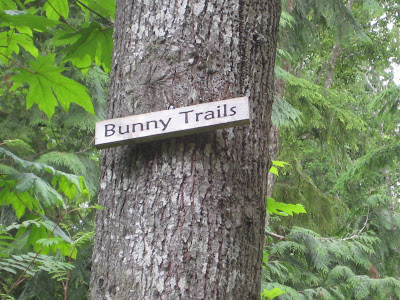
Bunny Trails branches off to the left (west) side of Pipeline road. We reach the entrance to Bunny Trails at 2.2 miles, 1 hour 4 minutes. The gently ascending trail is one of our favorites on Galbraith. At the first junction we turn left, then right at the next junction at 2.3 miles. I believe this is the point where the path becomes known as Banjoland.
After a pleasant walk in the lushness of Banjoland, we reach Bob's Rest Stop (2.6 miles, 1 hour 15 minutes). This is also a trail junction; we continue straight. In a few minutes the path comes to a T - we take the left path to head east, back towards Pipeline. We reach Pipeline at 2.9 miles, 1 hour 28 minutes. Turning right here, we're on our way back southward.
 |
| Entrance to Bunny Trails off of Road 1000 (Pipeline). |
On the way south, we decide to detour off of Pipeline road and take Road 2020. This road is an abandoned logging road and is really just a narrow grassy path. (3.5 miles, 1 hour 38 minutes.)
This is a pleasant route - a nice way to descend the southern part of Galbraith. Along the way, we see Lost Giants trail coming from the left and
Last Call on the right. (3.7 miles, 1 hour 43 minutes.) Just past that point we pick our way across a shallow creek. Shortly after that we go by
Meth Lab trail on the left, which we followed a few days ago.
 |
| Raney in the tall grass of Road 2020. |
Ultimately we get to the checkpoint Alpha kiosk, where we meet some friendly mountain bikers (4.1 miles, 1 hour 54 minutes.) We head out through the double gates on Galbraith Lane, and get back to the Padden Trails parking lot at 4.6 miles, 2 hours 4 minutes. It's been a pleasant trek this morning on Galbraith.
 |
| Homeward bound on the overgrown Road 2020. |
 |
| Elevation gains are gentle on this mostly flat route. |


No comments:
Post a Comment