Time: 1 hour 40 minutes
Here are trail notes from a hike I walked a week ago, on August 7th. The singular purpose of this hike is to walk Meat Grinder trail - a short trail that cuts eastward from Pipeline trail on the north side of Galbraith.
We are nearing completion of our goal to walk all of the 95 trails on Galbraith by the end of the summer. I've mapped out seven remaining hikes after this one, to cover the last ten or so trails.
We start the hike at Lopez right-of-way on the east side of Yew Street. (See directions to Galbraith access points.) It's a comfortable, cool morning for a hike, with high grey clouds overhead. The puddles that often settle in Lopez right-of-way have dried up after our past few hot days.
Following Lopez, we reach Pipeline trail at 0.4 miles, 8 minutes. Here we follow Pipeline straight south.
 |
| Raney skirts the small puddles on Lopez right-of-way. |
 |
| Looking southward on Pipeline trail. Steep ascent ahead! |
At 1.3 miles, 28 minutes, we go by the junction where the left fork goes to the north side kiosk (Checkpoint Kilo). We proceed on Pipeline, which now starts its long descent towards Samish Way. We're getting close now and are keeping our eyes open for signs of Meat Grinder trail.
 |
| Approaching the fork that leads to north-side kiosk. |
 |
| Looking over our shoulder at the north's bay view. |
Meat Grinder is ascending in this direction. It's pretty evident that this trail has not been used for a while; it's quite overgrown. Raney and I are picking up speargrass as we walk along, and navigating our route around branch piles in a few places.
After our brambly walk through Meat Grinder, it takes us to a logging road. (1.7 miles, 41 minutes.) We turn left here to find an entry point to Cedar Dust trail. After a bit of wandering, we come to the well-defined Cedar Dust trail. Turning left, heading back towards the north side kiosk on Cedar Dust.
Cedar Dust is one of the more popular and well-used trails on Galbraith. It's always a pleasure to hike it.
We reach the Checkpoint Kilo kiosk at 2.2 miles, 55 minutes. From here, there are only two ways to get down to Lopez right-of-way. One way is to take the logging road down to Pipeline and re-trace our steps. The other way is the much more interesting Bob's Trail, and we choose that route to make a loop out of our journey today.
In half a mile, we're at the end of Upper Bob's, and we follow Bob's Road which is a flat straightaway. In a hundred yards or so, we turn right to get on Lower Bob's trail.
 |
| Bob's Road, in between Upper and Lower Bob's. |
We come to the end of Lower Bob's at 3.3 miles, 1 hour 21 minutes. It terminates at Pipeline, where we turn right to continue our descent to Lopez right-of-way.
 |
| Lower Bob's, exiting out to Pipeline trail. |
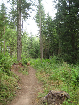
On the way down Pipeline, we decide to take Karma which is a nice shady side-trail. We often see woodpeckers on Karma, and today they are working industriously on a couple of old fir trees.
At 4.2 miles, 1 hour 40 minutes, we're back at Lopez right of way, and heading up Yew Street to home. I wouldn't recommend Meat Grinder as a destination trail, but once it's cleared it is a useful connector for getting between Pipeline and Cedar Dust trails.
 |
| Stick-chewing break on Karma. |


No comments:
Post a Comment