Time: 2 hours
Today we're off to hike Orient Express and Candy trails, going in from the north side of Galbraith.
We start at Birch Street parking lot, and walked up Birch Falls Drive to get to the start of Back Door trail. (See Galbraith access points for directions.)
At 0.7 miles, 16 minutes from the parking lot, we reach the end of Back Door trail and are now on the Back Door-SST Connector trail. Raney enjoys wetting her paws in the creek on the way up.
Soon we're on SST from the Connector trail. It's here that SST is marked with Do Not Enter signs. It's a one-way directional trail with riders descending at high speeds.
Hopefully on this weekday, even with the sunshine, there won't be much bike traffic out here. As soon as we can, we'll split off to The Old Up and get off SST's descending trail.
At 1.1 miles, 23 minutes, we reach a junction where an unnamed trail branches out to the left. That trail heads out eastward and ends up back on Powerline. At this point, on the right, is the narrow trail known as The Old Up - and that's where we head.

At 1.2 miles, 27 minutes, we come out to logging road and take a little dogleg left, which keeps us on the Old Up. (Turning left here would take us to Checkpoint Lima.)
We get through this upper part of the Old Up. It's slightly overgrown with thornbushes, blackberry vines, and stinging nettle all trying to tug at my shirt in different places. But it's a well-defined path nevertheless.
We come out onto an opening, and we're approaching Road 1240. Not far from here, SST will break away to the left.
At 1.6 miles, 37 minutes, we come to Road 1240, and here we branch away to the left to stay on SST. SST will run parallel to Road 1200 for a ways.
We're heading eastward now on SST. After some sharp climbing, SST levels out into a gentle ascent, and then a descent as it parallels Road 1200. It's a great walking trail, and I occasionally see hikers on this one.
At 1.8 miles, 44 minutes, we come to a tee. Going left goes to an orphaned road; turning right would go to Road 1200. We continue straight on SST.
At 2 miles, 48 minutes, we're at the end of SST, and at an important junction of trails here on Galbraith.
If we turn right, we'd be on Road 1200. To the left: 1200 Connector heads towards 3 Bears. Going straight would lead to Golden Spike. A slight dogleg left leads to Orient Express, and that's our destination today.
At 2.2 miles, 56 minutes, the trail is joined by Golden Spike coming in on the right. We continue straight, southward towards Road 2600.
Shortly, we're on Road 2600. We could cut across the road and continue on Golden Spike up towards Galbraith's old cabin. Today, though, we're turning Right on 2600, and then in a few steps turning right on 2600 Connector.
We're descending from here. There's a bit of logging debris here, with branches strewn across the path in different areas. Before long we see the trail going to the right. It's pretty much blocked by branches, which we scramble over.
At 2.5 miles, 1 hour 5 minutes, we come to junction where we take a sharp left turn to get us onto Candy trail. Candy is descending in this direction. It's paralleling Golden Spike; I can see bikers on it not too far away.
Candy is a bit overgrown in places. At one point Candy almost intersects with Golden Spike; then it veers away southward. It's fairly overgrown, it doesn't look this is heavily used by bikers recently. It seems that the preferred route is Golden Spike these days.
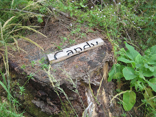
At 2.9 miles, 1 hour 20 minutes, we come out at the end of Candy, where an old broken sign sits. We turn right here on 2600 Connector.
Shortly, we then turn left on 1200 and head down to Wallace & Gromit trail.
Just a few steps past a big pile of logs, at 3 miles, 1 hour 22 minutes, we find the entrance to Wallace & Gromit. It's easy to miss, but if you look sharply you can see a small sign shortly up the trail.
At 3.2 miles, 1 hour 27 minutes, we come to the end of Wallace & Gromit. Wallace & Gromit is a bit more overgrown with blackberry vines than I remember it from the last time I hiked it a few weeks ago. I speculate that bikers are more often using Appendix to get to Family Fun Center.
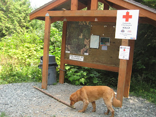
At 3.4 miles, 1 hour 35 minutes, we reach the north-side kiosk marked as Checkpoint Kilo. From here, we take Ridge Trail down towards the parking lot.
At 4.3 miles, 1 hour 52 minutes, we reach the end of Ridge Trail. We cross Powerline and follow Birch Street trail, then Miranda trail out to the Birch Street parking area.


No comments:
Post a Comment