Tuesday, July 31, 2012

Loop: Crazy 8s, Not Shawn's

Distance: 3.4 miles
Time: 1 hour 30 minutes

This morning Raney and I are off for a shorter hike, to cover two new Galbraith trails. It's a nippy morning, and even with a double layer of shirts it's cool hiking.


We start at Padden Trails parking lot on Samish Way, and in ten minutes are going by the kiosk labeled checkpoint Alpha. (See directions to Galbraith access points.)

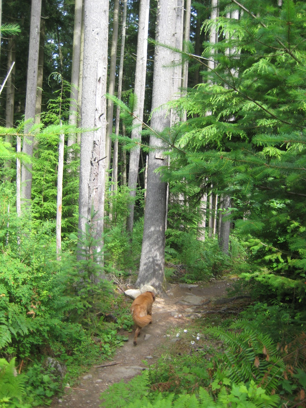
Headin' up Road 2000.

The steep climb warms us up quickly, and at 1.4 miles, 27 minutes we arrive at blue rock junction. Here we take the left fork to stay on Road 2000.

In a short time we go by the Checkpoint Charlie kiosk. We can see Mullet trail coming in from the right, and Cheech & Chong descending to the left.

Blue rock junction.

Checkpoint Charlie kiosk.

At this point we start looking for the next trail on the left, which will be Crazy 8s. At 1.6 miles, 32 minutes, we go by a big puddle, where Raney dives in - a tradition of hers whenever we go up Road 2000.

A few steps past that, we take the entrance to Crazy 8s on the left, bearing us westward. On today's short hike, we're as far north as we'll get today.


Entrance to Crazy 8s.
The first part of Crazy 8s is a nice, parklike setting, unlogged and picturesque. After that we go through a logged section and - at 1.8 miles, 38 minutes - we come to a sign for 911 trail. We double back a few steps and we can see a narrow branch-covered trail that must be Crazy 8s.


Oops! We hit 911 trail, and have to retrace to find Crazy 8s.

Before long, Crazy 8s comes to an area that's choked with piles of branches. We do a bit of scrambling, and after some route-finding we re-find the trail.

It takes work to continue. For a while we follow some logging equipment tracks to try to re-find the trail. My compass app tells me we're heading south-west. We proceed on, trying to re-connect the different sections of the trail amidst the logging debris.


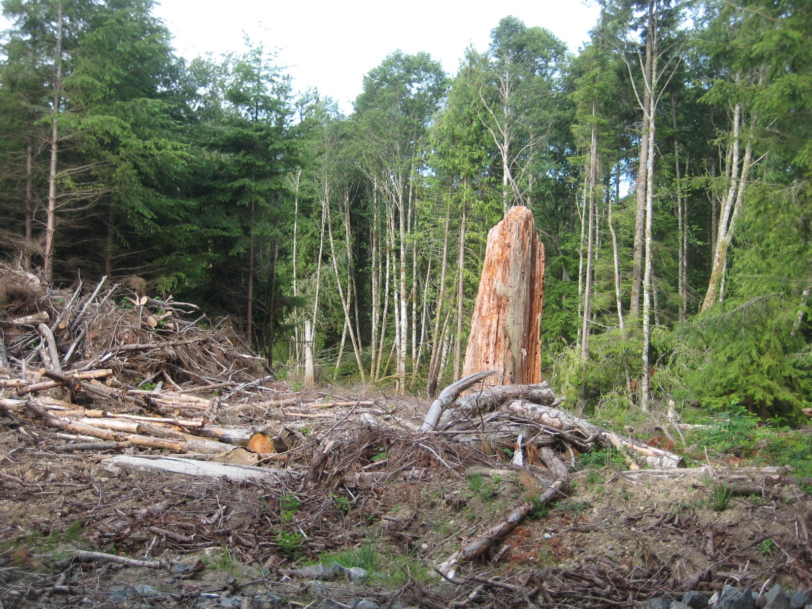
At 2 miles, 51 minutes, we come out on Road 2200. Now we're looking for Not Shawn's trail. I haven't found Not Shawn's on previous hikes, so will have to look more closely this time. 

At 2.2 miles, 56 minutes, we go by a distinctive orange pinnacle of a stump on the right side. It's a good landmark for Not Shawn's, which begins on the right about 500 feet later. The trail entrance is blocked by branches and somewhat hard to see.


Not Shawn's trail starts out pleasant enough...

...but quickly gets choked with logging debris and large branch piles.

Looks like we're two-for-two today on the trails: both have been covered by branches.

On Not Shawn's, we come upon some small stunts and boardwalks, mostly broken down.As we walk we find bits of pieces of the trail, and then it's intermittently blown away by the logging activities. It's slow going, and it takes some compass work and vectoring to make progress in the right direction.

Eventually we come out on an old logging road and that takes us to Road 2000. We turn right to head out.


Not Shawn's is Not Good right now due to logging clutter.
At 2.8 miles, 1 hour 19 minutes, we're going by Checkpoint Alpha on our way to the yellow gate out. We're back at the parking lot at 3.4 miles, 1 hour 29 minutes.

I can't recommend either of these trails at this time, but hopefully after some trailwork this fall they'll be usable again.

Passing the checkpoint Alpha kiosk on the way out.


Monday, July 30, 2012

Loop: Oly, Lost Sole, via summit, Tower Trail, and Keystone; return via Kaiser

Distance: 8.5 miles
Time: 3 hours 20 minutes

I'm looking forward to covering three new trails on Galbraith today. The route will include one of the best view hikes on Galbraith: Naughty Nelly trail. I'll also add Tower trail, Oly, and Lost Sole to our list of hiked trails.

Usually I hike with my pocket camera (a Canon SD750), and my iPhone camera as backup. Hoping for a good views, today I decide to lug along my Nikon D90 digital SLR as well.


Leaving from Padden trails parking lot, we go by the kiosk marked Checkpoint Alpha at 0.6 miles, 12 minutes from the parking lot. (See directions to Galbraith access points.)


We take logging roads up to the Galbraith summit. This involves following Road 2000 up to blue rock junction, where we turn right on Road 3000. (1.4 miles, 30 minutes.) The next fork is at red rock junction, where we turn right to stay on 3000. (2 miles, 40 minutes.)

At 2.4 miles, 50 minutes, we go by yellow rock junction. Road 3200 breaks away here to the right; we continue left on Road 3000, and are getting close to the summit at this point.

Turning right at blue rock junction.

Raney approaches red rock junction.

Road 3000 takes us past checkpoint Delta.

Continuing past yellow rock junction.

We reach the Galbraith summit at 3 miles, 1 hour 2 minutes. We go by the first two sets of radio towers, and checkpoint Echo. Walking past the left entrance to Scorpion/Evolution trails, we continue straight, past the third radio tower, and enter Tower trail.

At the Galbraith summit.


Walking past the 3rd tower towards Tower trail.

Tower trail is a flat path that runs right along the rim of a drop-off, practically a cliff. It's one of the few times I feel the need to keep Raney close; I've seen one dog drop off a steep cliff this year (at Miranda) and don't want Raney to suffer that.

Raney on Tower trail.

At 3.2 miles, 1 hour 11 minutes, we come out near checkpoint Foxtrot. From here we take Naughty Nelly trail off to the right. It looks like we're not going to get a break in the weather - it's misty and clouded in. After hiking the initial segment of the trail, I decide to bypass the rest of Naughty Nelly and take roads down to the junction of 4000. From there we turn right to follow Keystone road.


At checkpoint Foxtrot, heading towards Naughty Nelly.

The entrance to Naughty Nelly trail on the right.

Bellingham Bay from Naughty Nelly.

Lake Whatcom view from Nelly.
Coming to Keystone trail, we head west on it, working our way towards Oly and Lost Sole trails. (3.9 miles, 1 hour 28 minutes.)


Looking northward from Keystone trail.


After a pleasant half-mile on Keystone, we come to Road 2720. We follow this to Road 2722 which is near the entrance to Oly. (4.5 miles, 1 hour 44 minutes.)

At 4.7 miles, 1 hour 52 minutes, we find the trail branching off to the right to Oly East. A little cairn that used to be here has been torn down. Walking up Oly East, we come to its junction with Oly. Raney catches a rabbit here and swiftly kills it before I can intervene. I make her "drop it!" and "leave it!", and surprisingly she obeys promptly. Poor bunny.


Entering Oly East trail.


We come to the end of Oly at 5 miles, 2 hours. Right across Road 2050 is the entrance to Lost Sole. Lost Sole is a pleasant trail, progressing flatly through old woodlands.


In a few minutes we reach the end of Lost Sole. This is the most northern point we're going to hit on today's hike; from here we're going to head back southward on trails. Lost Sole ends at the junction of 2700 and 2000. We turn a sharp left on 2000 to double back southward, heading back to Oly.

At 5.6 miles, 2 hours 15 minutes, we turn left on Road 2050, which is just a little stub of a road that leads to Oly trail on the right. The day has improved abruptly, and the cloud layer has dissolved into bright blue skies overhead. We stop for a short water break.


After a pleasant half-mile on Oly, we come to Road 2722 which leads to the right and becomes Kaiser trail. (6.1 miles,2  hours 30 minutes.)

One of the longer Galbraith trails, Kaiser gently descends for a mile, ending up on Road 3000. (7 miles, 2 hours 51 minutes.) From here we retrace our steps southward down the logging roads. We come to the checkpoint Alpha kiosk at 7.8 miles, 3 hours 8 minutes.

Wildflowers brighten the lower end of Kaiser trail.
Raney with her bear bell.

From here we can see the yellow gate, where I put Raney back on her leash. We're back at the parking lot in 8.5 miles, 3 hours 20 minutes. 

For Raney and me, it's our longest hike yet on this Galbraith hiking quest. What a day for Raney, who's been off-leash for about 7 miles. Lucky dog!