Time: 3 hours 31 minutes
A good way to get to know Galbraith is to get lost in it! Raney and I intended to have a shorter hike this morning, but after a few wrong turns in Galbraith's mid-section, we ended up with a 7+ mile day.
I find that parts of Galbraith's northern sections can be confusing. There are many crossing trails and most are unmarked. The recent logging activity also appears to make my map a bit outdated, as trails are re-routed and new ones are created.
Armed with my WHIMPS map and the compass app on my iPhone, I manage to vector my way through a variety of trail forks. We end up covering six new trails and connecting roads on this beautiful Bellingham day.
 |
| Looking northward to Bellingham on Pipeline trail. |

Starting from our Yew Street home, and going up Lopez right-of-way, it's 10 minutes and about a half mile for us to reach Pipeline trail. We head south on Pipeline, passing by the upper end of Karma trail (0.85 miles, 16 minutes), and the endpoint of Lower Bob's (1 mile, 18 minutes).
 |
| Entering Galbraith from the Lopez right-of-way gate. |

 |
| The tall grass of Pipeline trail has been newly-mowed this morning. |
This section of Pipeline is among the steepest of any logging roads on Galbraith. Pipeline is the most direct route that cuts north-south across Galbraith. If we continued on Pipeline, we'd reach Samish Way and Lake Padden in about 3 miles.
 |
| Near Lower Bob's trail, a mountain biker ascends Pipeline. |
We turn off of Pipeline to follow Road 1000 to the left, at 1.5 miles, 30 minutes. We head to the north kiosk (checkpoint Kilo), reaching it at 1.8 miles, 38 minutes.
 |
| Road 1000 cuts away from Pipeline, leading to the north kiosk. |
 |
| Bellingham peeks at us through the morning mist. |

The kiosk marks the junction of four major trails. Our destination trail (Golden Spike) is to the east of us, so we follow Family Fun Center from the kiosk to get us going in that direction. A short ways down Family Fun Center, we reach a fork. The left fork just goes back up to Road 1000. We stay right, crossing the little bridge.


 |
| "Wishbone" tree on Family Fun Center. |
Family Fun Center ends at 2.1 miles, 46 minutes. We choose a left fork to follow Wallace & Gromit trail (unmarked in this direction). It's a fairly steep walk up Wallace & Gromit. There's some stinging nettle to avoid along the way. At 2.2 miles, 53 minutes, the trail comes up to Road 1200 where we turn left. We continue on Road 1200, bypassing another junction with Road 106 (labeled Road 1240 on my map).


Shortly, we come to 2600 Connector which crosses Road 1200 here. At 2.4 miles, 1 hour, we come to Checkpoint Juliet. SST 2.0 drops away to the left here. Nearby the road is crossed by a well-used path, not visible on my map. This path branches off of Candy on the left side.
Note: I believe that Checkpoint Juliet is marked on the wrong spot on my 2011 Galbraith map. It's possible that the checkpoint was moved since the map was created. Checkpoint Juliet is at the start of SST 2.0 on Road 1200; not at the bottom of SST 2.0 on Road 1240 as the map indicates. (Update: the 2012 map has this corrected.)


We stop for a water break (2.6 miles, 1 hour 4 minutes) and chat briefly with two women who are hiking up SST. Continuing on, at 2.8 miles, 1 hour 12 minutes, we come to a junction with a labeled SST trail coming in from the left. Just past this, Road 1200 ends. This marks a junction of trails: going straight leads to 1200 Connector; turning slight right is Orient Express, and choosing a sharper right trail takes you to Golden Spike and Candy trails.
This is where things get interesting for me. Following the sharp right route, we come to a 4-way junction of paths at 2.9 miles, 1 hour 18 minutes. It's not on my 2011 map, but I choose the right path as it seems to bear in the direction of Golden Spike - which roughly parallels Road 1200.

 |
| Zoomed-in GPS route of Golden Spike and Road 1200. |
 |
| Golden Spike trail veers close to Road 1200. |

By this time the early morning clouds have burned off and we have vivid blue skies overhead. Golden Spike descends in this direction - a nicely-maintained trail through attractive woodlands. After about ten minutes, Golden Spike comes down very close to the road and we can see checkpoint Juliet. There's a side trail that branches off to go right down to Juliet.
Eventually Golden Spike goes down a steep drop and then spits us out on Road 1200. I'm wondering now how to get on Candy which would end up on 2600 Connector. I decide to go back up 1200 to the trail entrance, and try another route. (3.2 miles, 1 hour 29 minutes.)

Ten minutes later we're back at the junction, and this time we go straight rather to the right. That ends in a bunch of brush, and doesn't look easily passable. So we double back again, and this time we take the left fork - the only other direction we haven't tried.
We go by a few forks that look like they may be side trails, and cross a connector road at 1 hour 45 minutes. Pulling out our compass, we're heading due south, and I conclude that we're now on Orient Express. Not sure how to get on Candy; we'll have to try that again another day.
We cross Road 2600, continuing on the trail which is now ascending steadily.
At 4 miles, 1 hour 53 minutes, the trail tops out and fingers into a maze of different trails. There are a bunch to choose from; I generally choose the right-most path, trying to vector to the west. A few minutes later, we encounter Road 2520, which shortly leads to a junction with Road 2500 at Checkpoint Golf.

This is good as we've been wanting to try out Sammy Tran trail. We follow Road 2500 to the left, and find the trail entrance at 4.3 miles, 2 hours 2 minutes. Sammy Tran meets up with Rusty Can which we walked a few days ago. We stay left to continue on Sammy Tran.
 |
| Trail entrance to Sammy Tran. |
In a few minutes Sammy Tran intersects with Kona Boys trail. We take the dogleg left and continue on Sammy. Eventually Sammy Tran ends by meeting up with Kona Boys (4.7 miles, 2 hours 12 minutes). We turn left and go downhill on Kona Boys.
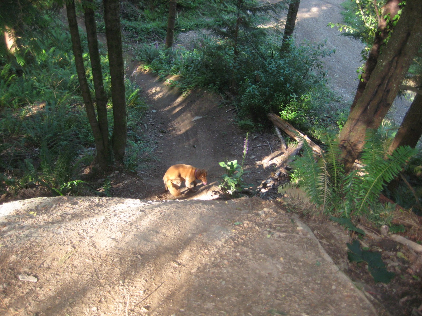
Soon we're at the end of Kona and we pick up Intestine trail. We're heading northwards now on Intestine. Intestine is another pleasant trail. We're getting more sun filtering through the upper branches.
At 5.2 miles, 2 hours 29 minutes, Intestine comes to a T. There are various trails here; we're going left here at the T, over the small stunt on a distinctive white rock (pictured below), and down to Road 1200.


Turning left on Road 1200, we go past trail entrance for Appendix. We're heading westward now towards Pipeline. At 5.6 miles, 2 hours 40 minutes, we're at the junction of Roads 1200 and 1230. This is where Cedar Dust trail bottoms out, and slightly up that trail we can see the marker for checkpoint India.
If we went left on Road 1230, we'd come to Bandito, which is a trail we'll do soon. But at this point we're ready to head homeward, so we turn right to remain on Road 1200. We follow that past 1210 and take a right on Road 1000 (Pipeline). We're at 6 miles, 2 hours 50 minutes into the hike.
 |
| There's no better blue than Bellingham blue. |

 |
| The checkpoint India marker has seen better days. |

 |
| Homeward bound on Pipeline. |


 |
| The mowers are still at work on Pipeline as we descend. |
We walk just over a mile down Pipeline, and turn left on Lopez right-of-way at 7.2 miles, 3 hours 18 minutes. A few minutes later we're back where Lopez right-of-way meets Yew Street.
From here it's a short walk up Yew Street to our home. By the time I'm unlacing my boots, we are at 7.7 miles, 3 hours 31 minutes. A longer hike than planned, but it's been a great way to spend this sunny Bellingham morning.

No comments:
Post a Comment